Helicopter-borne radar survey of Swiss glaciers completed
November 2019 - by Lasse Rabenstein, Lino Schmid and Melchior Grab, along with Andreas Bauder, Christoph Bärlocher and Lisbeth Langhammer
The retreating Swiss glaciers present many challenges for hydropower usage: What water reserves are available today and in the future and which glacier beds could serve as sites for new reservoirs after the glacier retreat? The thorough and complete measurement of the glacier volume and the topography of the glacier beds offers answers to these questions.
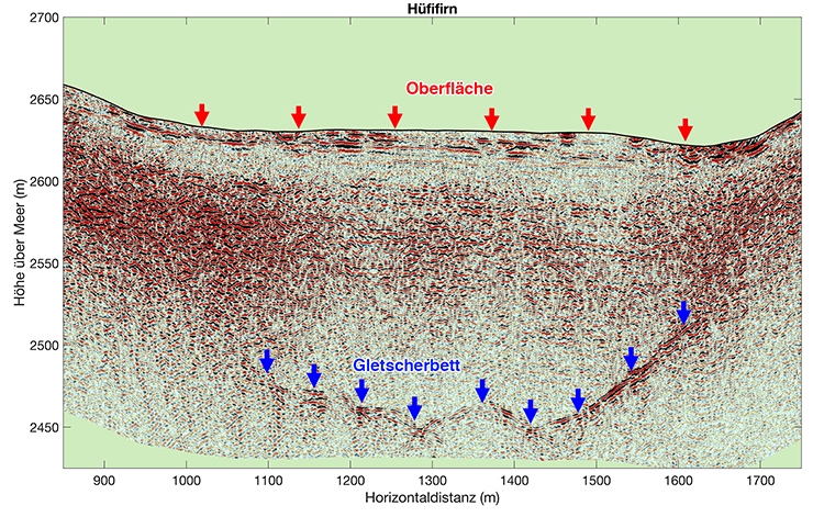
Field data existed only for individual glaciers until a team of scientists from the Laboratory of Hydraulics, Hydrology and Glaciology (VAW) and the Institute of Geophysics (IfG) of ETH Zurich within the SCCER-SoE framework set the ambitious goal to measure the glacier bed topography as accurately as possible and compute the total ice volume.
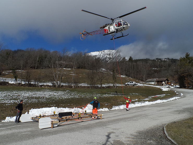
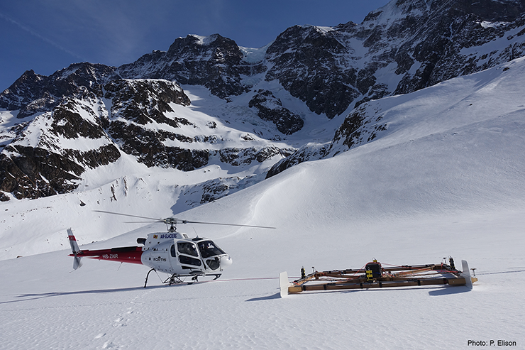
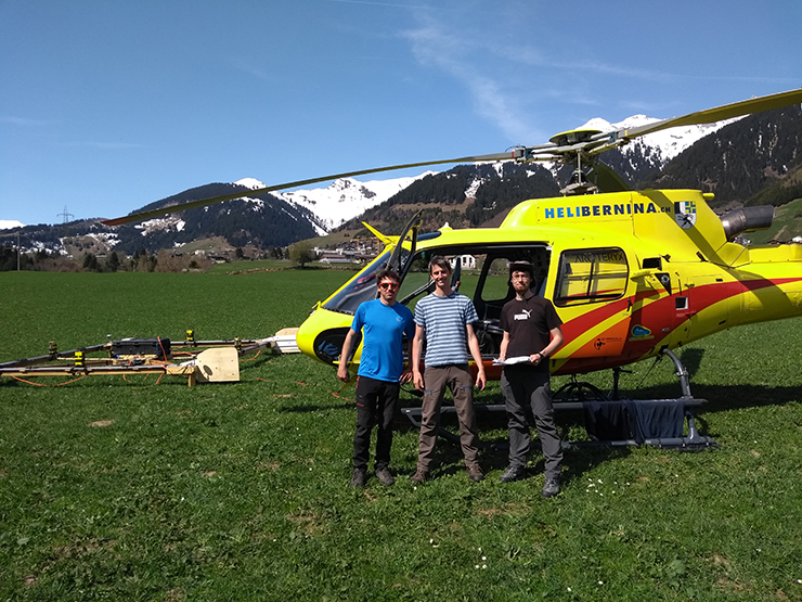
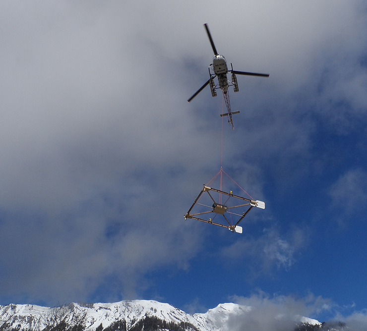
A helicopter-borne radar platform was developed in the first phase of the project from 2014 to 2015 to enable efficient measurements of the ice thickness in inaccessible areas, as well as software for data processing. The radar platform is the first of its kind to use two orthogonal antenna pairs during measurements. This enables researchers to acquire data in the best possible quality, as they can optimally position the antennas even when measuring complex glacier bed topography.
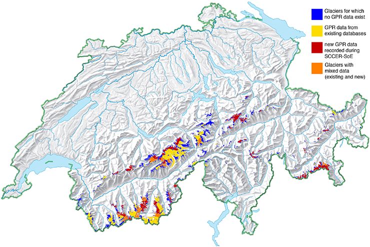
After successful tests, the team started regular measurements in 2016. Ice thickness data along measurement profiles with a total length of 1400 kilometres already existed from a time before the SCCER-SoE. These are mostly from the larger glaciers in Valais. Between 2016 and 2019, the team expanded this database with many additional measurement profiles to a total of about 2500 kilometres. After over 5 years of work, this measuring campaign concluded last April in the area between Rosenlauigletscher and Kanderfirn in the Bernese Oberland. Besides many glaciers in the Valais and the Bernese Alps, the team mainly covered areas in central and eastern Switzerland. This means that all glaciated areas in Switzerland are surveyed now, with the exception of smaller and geographically highly isolated glaciers.
To conclude this project, the team will use the following months to incorporate the radar measurements of ice thickness profiles into a specially developed glacier model to produce continuous maps of ice thickness and glacier bed topography. This model will be used by the team to calculate the total ice volume existing in the Swiss Alps.
Partners
Cooperation partners for this project are BRTechnik, GEOSAT SA as well as Air Glaciers. The project was heavily funded by the SCCER-SoE (Task 2.1) and the field campaigns were enabled through support of the Swiss Geophysical Commission (SGPK).
