The GECOS project: reducing subsurface uncertainties by the smart use of field-based integrated geophysical investigations
The economics of deep and medium depth geothermal projects rely to a great extent on cost-effective geophysical exploration techniques. How can these be designed and deployed with a fit-for-purpose approach to achieve more effectively a satisfactory image of the subsurface and its uncertainties? These are the questions at the core of the GECOS project.
The Geothermal Energy Chance of Success GECOS (Project n. 26728.1 PFIW-IW) project, co-funded by Innosuisse, Services Industriels de Geneve and Geo2X S.A., aims at improving exploration investigations which are designed and implemented for the development of geothermal resources and underground thermal energy storage (UTES) projects.
The GECOS project is based on the need of industrial partners to reduce the uncertainty of subsurface exploration and the risks associated with drilling operations. The Geneva Basin subsurface and the whole Swiss Molasse Plateau show favourable conditions for geothermal heat production (and storage where possible) from the fractured and karstified Mesozoic carbonates. These are potentially highly productive reservoirs, as demonstrated by the 744 metres deep GEo-01 well which has been recently completed in Geneva in 2018 in the framework of the Geothermie2020 programme.
However, the uncertainties related to fault architecture and fracture network might still be high despite investing in standard geophysical exploration (i.e. active seismic). Additionally, the Geneva Basin is an active petroleum system, which means that hydrocarbons such as natural gas are present in the subsurface. The occurrence of hydrocarbons is an element of risk that can hinder the development of geothermal projects if not properly constrained and managed.
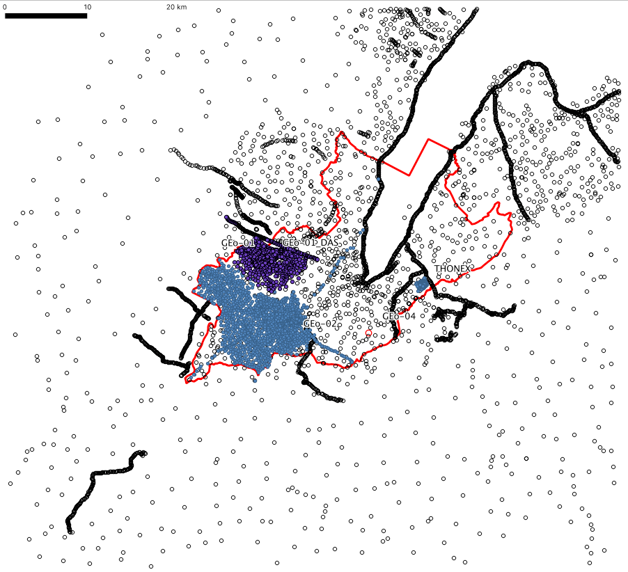
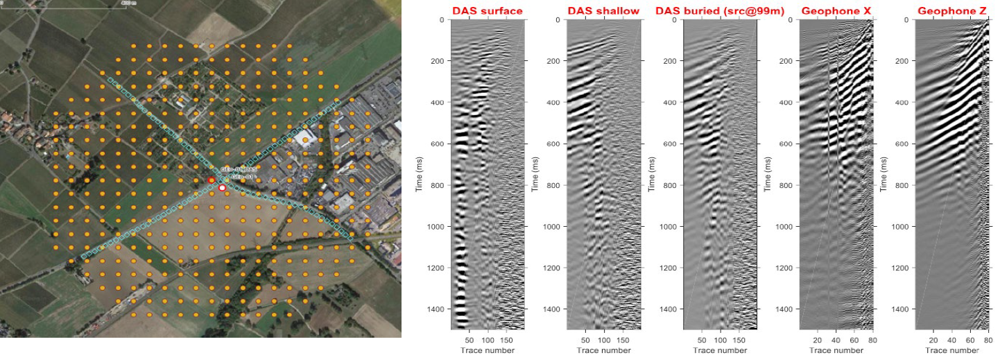
Gravity stations across the Geneva area. Black dots are the data from the gravimetric atlas of Switzerland and from the Bureau International de Gravimetrie. Blue and purple dots indicate the new acquisitions (blue: 2018; purple: 2019-2020).
Research objectives of GECOS
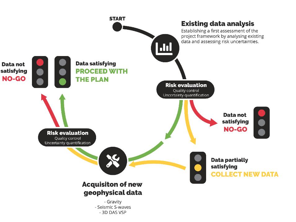
The research of GECOS focuses on three aspects. First, to reduce the subsurface uncertainty through the acquisition of high-resolution and cost-effective data such as 3D Distributed Acoustic Sensing Vertical Seismic Profiling (DAS VSP), Shear-waves and high-resolution gravity. Second, to quantify the uncertainty of subsurface data through the integration of geophysical and geological data using geo-statistics. The third focus of the project lies on the reduction of the interpretation times and the overall project costs by applying machine learning techniques. This approach allows integrating new with already available data and improves the understanding of the subsurface in a cost-effective manner.
Results of the first step: acquisition, processing and interpretation of high-resolution geophysical data
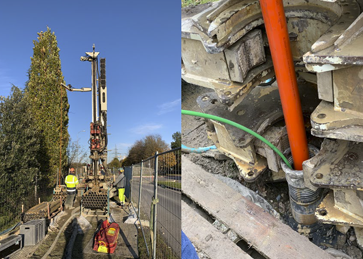
The scientists employed gravity data to constrain the geometry of the Quaternary sediments and to define the base of the Cenozoic Molasse sequence. They combined S-waves active seismic with gravity to improve the definition of the geometry of the Quaternary sediments and test the sediments’ potential for the identification of shallow hydrocarbon pockets. Furthermore, they will collect VSP data to characterize larger depth within the Molassic sequence and the upper Mesozoic units. The VSP survey will be performed in a dedicated well that has been specifically drilled for the GECOS projects a few tens of meters next to the GEo-01 well site which will be used as a calibration point. Seismic signals will be recorded by both standard receivers and by optic fibre which are installed in the dedicated well. The application of DAS receivers is an innovative approach that has the potential to provide very high spatial resolution compared to conventional strings of (few) downhole geophones, and robust optic-fibre cable that can be permanently installed in the well for time-lapse monitoring. However, for the survey planned in GECOS, the scientists decided to install both types of receivers to validate the results of DAS receivers by comparing with standard receivers. Additionally, the scientists intend to deploy wireless receivers on the surface on a 3D grid to enhance the illumination of the subsurface.
Next steps
The first step will result in a set of geophysical data. In the second step the scientists will quantify the value of the new data with respect to existing data by calculating how the new data contributes to the reduction of the subsurface uncertainty. Preliminary results clearly show how the new high-resolution acquisition improved the resolution of the shallow subsurface.
Collaboration and funding
The University of Geneva (UNIGE) ideated the GECOS project in collaboration with the Swiss Federal Institute of Technology in Zurich (ETHZ). GECOS is supported by Innosuisse (Project n. 26728.1 PFIW-IW), SIG and Geo2X and benefits from the synergies between industrial operator and academic scientists enabled by the SCCER-SoE .The GECOS project runs until the end of 2020.
